
How does GPS work when a navigation app places a blue dot on a street? Behind that instant result is a carefully coordinated system of satellites, ground stations, radio signals, atomic clocks and mathematics. Your phone measures signals that have travelled more than 20,000 kilometres from space, then turns tiny differences in arrival time into a position on Earth.
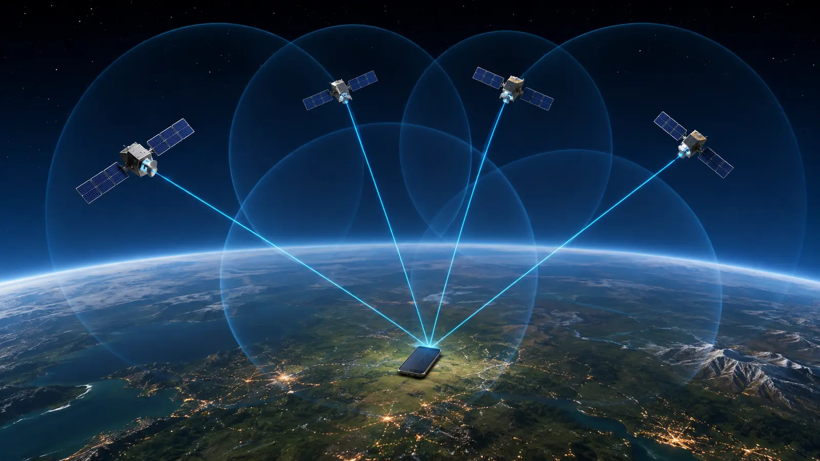
A GPS receiver listens for one-way signals from several satellites. Each signal tells the receiver where the satellite was and when the signal was transmitted. By measuring how long the signals took to arrive, the receiver estimates its distance from the satellites. It then combines at least four measurements to calculate latitude, longitude, altitude and an accurate time correction.
Quick answer: GPS satellites act like extremely precise radio beacons. Your phone does not send a location request to them. It receives their time-and-position messages, measures the signal travel times and solves where the measured distances intersect.
What is GPS?
GPS stands for Global Positioning System. It is a satellite-based system owned by the United States and operated by the U.S. Space Force. Its civilian service is available continuously around the world. GPS provides three closely connected services:
- Positioning: finding latitude, longitude and altitude.
- Navigation: using repeated position measurements to determine direction, speed and movement.
- Timing: distributing a highly accurate time reference to receivers and infrastructure.
GPS is not the map shown on your screen. The satellite system helps a receiver calculate coordinates. A mapping app then places those coordinates on stored map data, searches for roads and addresses, and may use an internet connection to download traffic or route information.
GPS is also one member of a wider family called the Global Navigation Satellite System, or GNSS. Other satellite-navigation constellations include Europe’s Galileo, China’s BeiDou and Russia’s GLONASS. Many modern phones combine signals from several constellations, even though people commonly call the whole location process “GPS.”
The three parts of the GPS system
GPS works because three segments cooperate: satellites in space, monitoring and control facilities on Earth, and receivers used by people and machines.
1. The space segment
The space segment is built around a nominal constellation of 24 operational satellites, with additional satellites commonly available to improve coverage and resilience. They travel in medium Earth orbit and circle the planet roughly every 12 hours. Their orbits are arranged so a receiver with a reasonably clear view of the sky can usually detect several satellites from almost anywhere on Earth.
Every satellite continually broadcasts a navigation message. This includes a precise transmission time, information about the satellite’s orbit and data that helps receivers understand the wider constellation. The transmission is one-way: the satellite sends the signal without knowing who receives it.
2. The control segment
A worldwide network of ground facilities tracks the satellites, checks their health and measures their orbits and clocks. The control system calculates updates and uploads corrected navigation data. It can also command orbital adjustments when necessary.
This ground work matters because a receiver needs to know where each satellite was when its signal left. A small satellite-position or clock error can become a larger error in the location calculated on Earth.
3. The user segment
The user segment includes every compatible receiver: smartphones, vehicle navigation units, aircraft systems, survey equipment, scientific instruments, ships, farm machinery and many other devices. A receiver needs an antenna, radio hardware and software capable of decoding navigation signals and solving the positioning equations.
The receiver is passive in the basic GPS process. It listens, calculates and displays. This is why the GPS satellites themselves cannot track a lost phone. A phone or app may separately share its calculated location through a mobile or Wi-Fi connection, but that is a different process.
How does GPS work step by step?
The central idea is simple: if you know the positions of several satellites and your distance from each one, you can calculate the point where those distances agree. Achieving this in the real world requires extraordinary timing precision.
Step 1: The receiver finds available satellites
After the GPS receiver starts, it searches for recognizable satellite signals. It identifies the satellites it can see and collects their navigation messages. A current receiver may also listen to Galileo, BeiDou, GLONASS or regional systems, giving it more measurements to choose from.
A clear sky makes this easier. Roofs, concrete, mountains, dense trees and even the human body can weaken or block the faint signals by the time they reach the ground.
Step 2: Each satellite sends its position and time
The navigation message tells the receiver when the signal was transmitted and provides the orbital information needed to determine the satellite’s position at that moment. GPS satellites carry atomic clocks because errors of only tiny fractions of a second would create large distance errors.
Step 3: The receiver measures signal travel time
Radio signals travel at approximately the speed of light. The receiver compares the transmitted time encoded in a signal with the time it arrived. It converts that delay into an estimated range using a familiar relationship:
Distance = signal speed × travel time
Light travels about 300 metres in one microsecond. That means a timing error of only one millionth of a second can produce a range error of roughly 300 metres. GPS receivers therefore work with timing differences far smaller than the blink of an eye.
Step 4: The receiver uses trilateration
People often call this process triangulation, but trilateration is the more accurate term. Triangulation mainly uses angles. Trilateration determines a position from measured distances to known points.
Imagine a sphere centred on each satellite. The radius of a sphere equals the measured distance from that satellite to the receiver. One sphere leaves many possible positions. A second narrows them to a circle, and a third reduces the possibilities further. In an ideal system with a perfectly synchronized receiver clock, three satellites could describe a three-dimensional position. Real receivers need another measurement.
Step 5: A fourth satellite corrects the receiver’s clock
The atomic clocks in orbit are extremely accurate, but the clock in an ordinary phone is not. Giving every phone an atomic clock would be impractical and expensive. Instead, the receiver treats its clock error as one more unknown value.
Measurements from at least four satellites allow it to solve four unknowns: latitude, longitude, altitude and receiver-clock offset. This is why explanations of GPS normally say four satellites are required for a full position and accurate time. More satellites can improve reliability and help the receiver reject poor measurements.
Step 6: Software turns coordinates into useful navigation
The raw solution is a set of coordinates and a time. Navigation software may combine it with motion sensors, nearby Wi-Fi information, mobile-network data and previous positions. A map app then matches the location to roads or paths, estimates direction and calculates a route.
This final stage explains why a wrong address is not always a GPS failure. The calculated coordinates may be reasonable while the map has a missing road, an incorrectly placed business or an inaccurate street label.
Why atomic clocks and Einstein’s relativity matter
GPS depends on clocks that remain synchronized even though the satellites are moving quickly and orbiting where Earth’s gravity is weaker. According to special relativity, motion makes the satellite clocks run slightly slower than clocks on the ground. According to general relativity, weaker gravity makes them run faster.
The general-relativity effect is larger. NIST explains that the two effects combine to make GPS satellite clocks run about 38 microseconds per day faster than comparable clocks on Earth. Engineers account for this predictable difference. Without relativistic corrections, positioning errors would rapidly grow until navigation became useless.
This makes GPS an everyday demonstration of modern physics. A theory associated with distant stars and curved spacetime helps a phone guide someone to a nearby shop.
How Does GPS Work and How Accurate Is It?
There is no single accuracy figure for every device and location. GPS.gov reports that a GPS-enabled smartphone is typically accurate to within about 4.9 metres (16 feet) under open sky. The result can become worse near buildings, bridges and trees. Professional dual-frequency receivers, correction services and augmentation systems can reach centimetre-level accuracy, while specialized long-term measurements can be even more precise.
The accuracy experienced by a user depends on more than the satellites. Important factors include:
- the quality and frequency support of the receiver;
- the number and arrangement of visible satellites;
- delays as signals travel through the atmosphere;
- obstructions between the satellite and receiver;
- reflections from buildings or the ground;
- radio interference, jamming or deceptive signals;
- the quality of the map or application using the coordinates.
Why does GPS sometimes show the wrong location?
Buildings and indoor spaces block signals
GPS signals arrive at Earth with very low power. Metal roofs, reinforced concrete and underground structures can weaken them so much that a phone cannot obtain a reliable measurement. A device indoors may fall back to Wi-Fi, mobile-network or previously known location data.
Reflections create multipath errors
In a city, a signal may bounce off glass, concrete or the ground before reaching the receiver. The reflected route is longer than the direct route, so the receiver may interpret it as extra distance from the satellite. This is called multipath, and it is one reason the blue dot can jump between streets among tall buildings.

The atmosphere delays radio signals
Signals do not move through the ionosphere and lower atmosphere exactly as they move through a vacuum. Receivers use models and, where supported, measurements from more than one frequency to reduce these errors. Dual-frequency reception is now available in some consumer devices as well as professional equipment.
Poor satellite geometry weakens the solution
Four satellites clustered in one part of the sky provide a weaker geometric solution than satellites spread across different directions and elevations. Receivers describe this effect using dilution of precision. More visible satellites do not automatically guarantee perfect accuracy, but a well-distributed set usually helps.
The map can be wrong even when the coordinates are right
GPS calculates a position; it does not maintain every digital map. A navigation app may contain an outdated road, a misplaced address or an incorrectly labelled business. If the blue dot remains stable but appears beside a wrongly drawn road, the map data may be the real problem.
How Does GPS Work Without the Internet?
GPS itself does not require an internet connection. A receiver can calculate a position from satellite signals alone. That is why dedicated outdoor receivers can work far from mobile coverage.
An internet connection can still make a phone’s location experience faster and more useful. Assisted GPS may download satellite-orbit or timing assistance instead of waiting to collect everything from the satellites. Maps, live traffic, business searches, satellite imagery and route updates may also need data unless they were downloaded in advance.
In short: the location calculation can work offline, but the map and online services surrounding it may not.
How Does GPS Work With Other GNSS Systems?
| Term | Meaning |
|---|---|
| GPS | The Global Positioning System operated by the United States. |
| GNSS | The general category of global satellite-navigation systems, including GPS and other constellations. |
| Multi-GNSS receiver | A device that can combine compatible signals from more than one constellation. |
Access to more constellations can help a receiver see more satellites, especially where part of the sky is blocked. It can improve availability and shorten the time needed to obtain a position. The exact benefit depends on the receiver, antennas, supported frequencies, software and surroundings.
GPS does more than provide driving directions
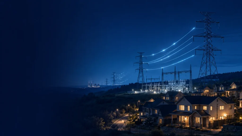
Navigation is the most visible use of GPS, but precise time is equally important. GPS timing helps synchronize mobile networks, data systems, scientific instruments and parts of the electrical grid. Surveyors use advanced receivers to measure land and infrastructure. Farmers use satellite navigation for precise machine guidance. Aircraft and ships use it as part of wider navigation systems, and emergency services use location technologies to coordinate responses.
Financial and communication networks also depend on consistent timestamps. The same signals that help a phone find a road can help distant equipment agree on when an event occurred.
Frequently asked questions
How does GPS work on a phone?
A phone’s receiver measures signals from multiple navigation satellites and solves its coordinates and clock error. The phone can then combine that result with motion sensors, Wi-Fi and mobile-network information before a map app displays the position.
Why are four satellites needed for GPS?
The receiver needs to solve latitude, longitude, altitude and its own clock error. Four independent satellite measurements provide enough information for those four unknowns. Additional satellites can improve the solution and help identify weak measurements.
Can GPS satellites track my phone?
No. GPS satellites broadcast one-way signals and do not know which devices receive them. Your phone calculates its own location. An app, mobile network or emergency feature can transmit that location separately if it has permission and a communication connection.
Why does GPS work better outdoors?
Outdoor receivers usually have a clearer view of the sky. Indoors, roofs and walls block or weaken signals, while nearby surfaces can create reflections. Moving near a window may help, but deep indoor and underground reception is often unreliable.
Is GPS free to use?
The civilian GPS signal is provided worldwide without a direct usage fee. Users may still pay for a receiver, a phone, mobile data, mapping subscriptions or specialized correction services.
Does turning on GPS use mobile data?
Receiving GPS signals does not itself use mobile data. A navigation app may use data to download maps, traffic, search results or assistance information. Downloaded offline maps can reduce that requirement.
Can GPS work during bad weather?
Ordinary rain and clouds usually do not stop GPS. The more common problems are buildings, indoor use, dense cover, poor satellite geometry and radio interference. Severe space-weather events can affect signals, but they are much less common than everyday obstruction and reflection.
The simple idea behind a precise global system
So, how does GPS work in simple terms? GPS turns time into distance and distance into location. Satellites broadcast where they are and when their messages left. A receiver measures the arrival times, estimates its ranges to several satellites and uses trilateration to solve its position. A fourth satellite lets it correct its imperfect clock, while ground stations keep the space system accurate.
The calculation happens quietly in a phone, vehicle or instrument, but it connects atomic physics, orbital engineering, radio communication and geometry. The next time a blue dot settles on a map, it represents far more than a point: it is the result of synchronized clocks and signals crossing thousands of kilometres from space.
Like GPS, the internet also depends on an enormous global infrastructure. Read how the internet crosses oceans through submarine cables.
Transparency
Sources & references
Editorially reviewed
Editorial information
SOAKJAM articles are designed for clarity, useful context and transparent sourcing. Important facts should be checked against the linked primary sources.
Found an error, outdated detail or a useful source we should consider?